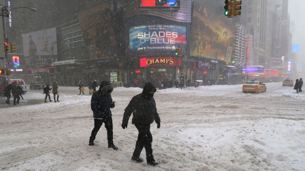
(NEW YORK) — A significant nor’easter is expected to march up the East Coast on Sunday into Monday, bringing significant snow for the I-95 corridor and placing New York City under a blizzard warning for the first time in nearly a decade, with the last one coming in March 2017.
As of Saturday morning, more than 40 million Americans are on alert for winter storm conditions beginning on Sunday and continuing into Monday.
The National Weather Service has upgraded southern Delaware, the Jersey Shore, all of New York City, Long Island and coastal Connecticut to a blizzard warning for increased confidence in snowfall of more than one foot and gusty winds that will likely cause blizzard conditions.
Coastal flood watches are also up from coastal Delaware to the Jersey Shore and Long Island to the coast of southern New England for minor to moderate coastal flooding during high tide.
As the forecast continues to become clearer, expect additional winter weather alerts to be issued over the next 24 hours across the Northeast.
While the exact snowfall totals and which locations will get the most precipitation from the storm remains uncertain, confidence has increased that the eastern seaboard will be dealing with a powerful coastal storm Sunday through late Monday that will bring significant snowfall, high winds and coastal flooding.
This coastal storm is expected to start taking shape over the coastal Carolinas on Sunday, bringing rain to the Mid-Atlantic and some scattered light to moderate snow from Northern Virginia up into Pennsylvania and into parts of New Jersey and New York come Sunday morning into the afternoon.
By late Sunday afternoon, the coastal storm will begin to quickly intensify off the coast of North Carolina and Virginia as it tracks to the Northeast and parallels the East Coast.
By early Monday morning, the storm is anticipated to bring heavy snow, strong wind gusts and coastal flooding across much of the coastal Northeast.
The Jersey Shore, Long Island, the southern coast of New England and Cape Cod could all see blizzard and whiteout conditions early Monday from the combination of heavy snow and very strong wind gusts.
By Monday evening, snow should begin to taper off almost completely for the Northeast except for New England which could still see intermittent precipitation.
Copyright © 2026, ABC Audio. All rights reserved.
